Boston Kayaker

Kayaking on Winooski River - from Montpelier VT to Middlesex VT


Unrated - The Boston Kayaker does not have enough information or time to make a rating.

  Put in at Montpelier High School on
  Bridge Street in Montpelier VT.
Take out at Route 100B bridge
  before dam in Middlesex VT.
Estimated distance
  = 5 miles
Route 12
  Dam
Middlesex
  Dam
Class I-II
  rapids
  River name came from Abenaki
  word meaning "wild onion".
Vermont State House
  - guided tours available
Route can be scratchy
  in August / September.
Dog River enters
  on right.
Hubbard
  Park
 

Disclaimer: It is your responsibility to determine the legality, suitability and safety of this route for yourself.

Download printer-friendly
PDF version that fits in one page:
Kayaking on Winooski River - from Montpelier VT to Middlesex VT

Other resources:
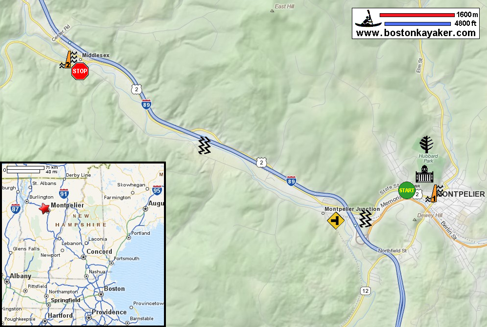
Friends of the Winooski
Friends of the Winooski: Paddling Guide (16mb pdf), see pages 14 to 15
Friends of the Winooski: Paddling Guide (cached copy)
Vermont's Historic State House
Montpelier VT: Hubbard Park


Excerpts from Friends of the Winnooski Paddling Guide (page 15):
Difficulty: Intermediate
Description: The Winooski is wide in this section with a number of fairly straight stretches. In August and September, the river can be quite shallow requiring skill in seeking good travel channels.
Rapids/Obstacles: Occasional boulders and underwater rocks require paddlers to stay alert. In addition, two short ledges require basic skill to navigate. The first is at Cemetery Corner, shortly after the High School put in. In the summer, start left and move right to avoid the ledge. The other is just below Jones Brook entrance on the left. The ledge is most passable on the far right, but can have a steep drop. It is easily portaged on the left side.
Put In:
  • Montpelier High School: The put in is about 100 yards below the Bailey Avenue bridge. There is short easy path off the bike/pedestrian path.
    Take Out:
  • Just above Middlesex Dam: The take out is on the left just beyond the Rte 100B bridge. The bank is steep and can be muddy. The dam is marked by barrels across the water during summer months. You must exit here. You can portage the dam to continue.