|
Download printer-friendly
PDF version that fits in one page: |
Other resources:
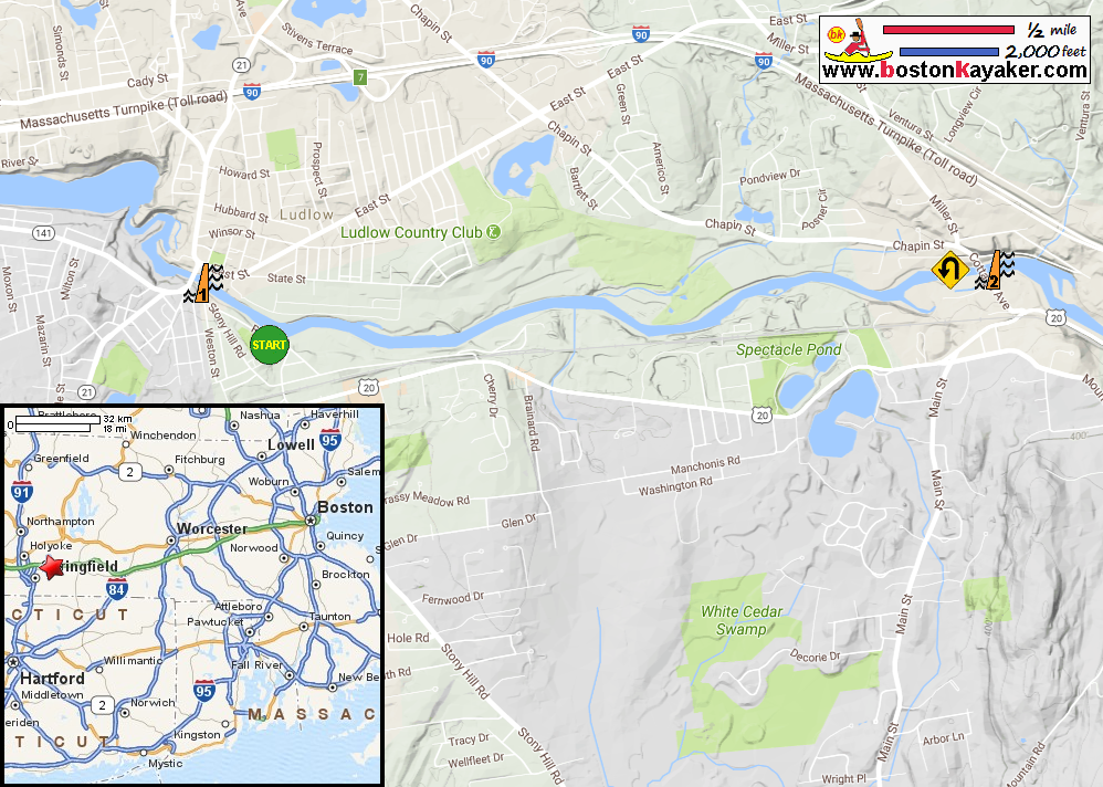
Paul Samson's Kayaking Blog: Chicopee River Below Red Bridge Dam Paddling.net: Chicopee River Kayak Trip Report All photos in this website are original and copyrighted. At the public put in to Chicopee River on River Road in Wilbraham MA. Trip date is August 2017. Just launched on the Chicopee. Glanced to my right to see the buoys marking the Putts Bridge Dam. Veered left. Paddling east upstream on Chicopee River. River bending to the left . . . A rail bridge coming up. Continuing east past the railbridge. IMG_7496.JPG I can hear the electricity passing thru the power lines (zzzzz . . . ) River mostly straight with little bends. A bird in flight over the Chicopee River. I can now see part of the Cottage Avenue bridge. The current is getting stronger here. I can also see the Collins Dam just behind the bridge. In front of the bottom of the Collins Dam on Chicopee River. Warning on the dam structure says "Water may rise rapidly". This is my point of return. Turning around . . . the underside of Cottage Avenue bridge. Now facing west downriver with the Collins Dam behind me. A paddler on a canoe. This guy on the canoe is paddling fast. He went to the dam and back and now overtook me. Riverfront backyard with picnic table and hammock. The two ladies I met earlier at the put in. Now the railbridge. The takeout is on my left now. Will paddle a bit to approach the Putts Bridge Dam. Approaching Putts Bridge. This is as close as I will go. Just behind the "Danger Stay back" sign. Just turned around. Landed. Paddle time is 2 hours 10 minutes. The Putts Bridge Dam viewed from the Putts Bridge. Looking east from the Putts Bridge, the Chicopee River continues and tumbles over the Wallamanumps Falls. |