 Kayaker

|


|
Download printer-friendly
PDF version that fits in one page: |

|
|
Other resources:
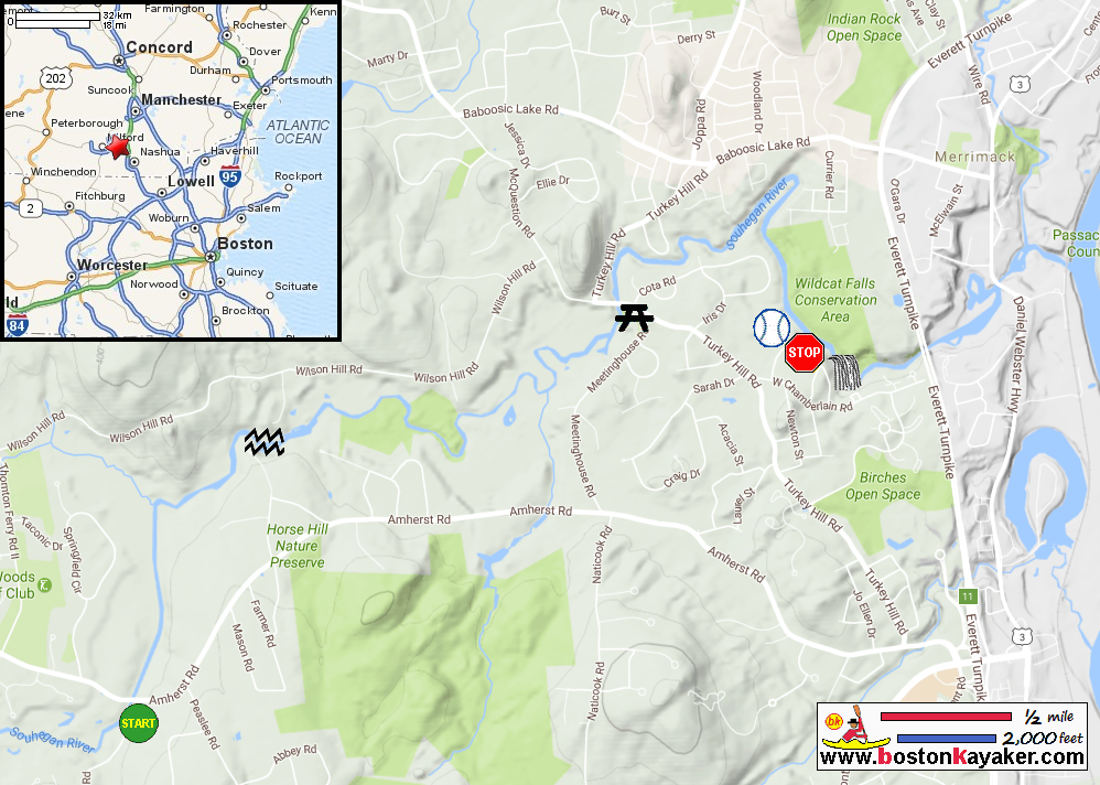
Souhegan Watershed Association: Souhegan River Canoe Guide (see Trips 8 and 9) All photos in this website are original and copyrighted. Trip 8: Severns Bridge to Davidson Road - 2 miles - 1.5 hours Description: Class 3, quickwater, flatwater Navigable: High water in the spring/all summer Scenery: Forested, rural Although high water is necessary to get all the way to the next takeout, this is a popular spot to put in and paddle both upstream and downstream and back to your car during the summer. Continuing downstream, boaters will notice that the sandy bottom through Amherst has given way to rocky boulders indicating rapids ahead. After about a mile the river takes a sharp right turn and drops over a Class 2 ledge best run on the right. There is a big, red barn on the steep right bank. The pool below is above two islands. Take out on the head of the right island to scout or carry. This is Indian Ledges. Run down between the two islands and eddy on the right on the ledge. From here it’s an easy carry around the more shallow rapid ahead. If there is enough water, the rest of the rapid may be attempted, but expect to hit a rock or two. Staying center, left may be best. One may take out or put in here from the end of Davidson Road, which is off Amherst Rd. Trip 9: Davidson Road to Weston Park - 2 miles - 1.5 hours Description: Flatwater Navigable: All year Scenery: Forested, rural From here it is mostly smoothwater to Turkey Hill Bridge. Take out on the right into the parking lot just before the bridge. This is Weston Park, a public access created with the support of the SWA. Trip 10: Weston Park at Turkey Hill Bridge to Wildcat Falls - 1.5 miles - 1 hour Description: Flatwater Navigable: All year Scenery: Forested, rural There is a small rapid after about 0.5 mile. Otherwise this is a huge meander all the way to the falls. The falls should not be attempted by most boaters. The take out is at a clearing on the right. There is a small power line overhead. To drive to the take out, go to the Merrimack DPW Garage on Turkey Hill Road. Drive all the way in alongside the furthest ballfield. Park under the powerline. This marks the furthest practical place to go on the river. However, if you wish to either see Wildcat Falls (and it’s worth it) or to portage around, take out on the left side of the river. This is the 80 Acre Conservation Park in Merrimack. There are trails all through along the river. The opposite bank is an unattractive jumble of cottages. 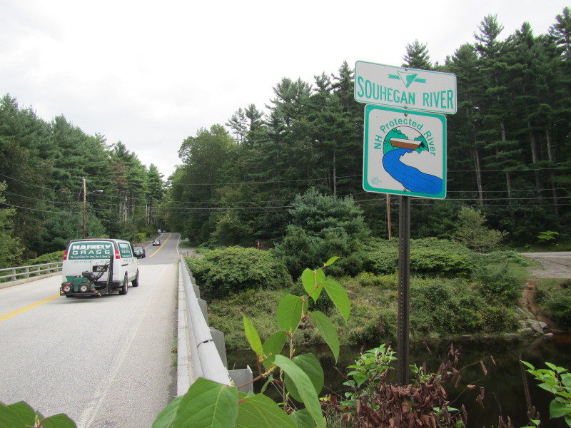 The Souhegan River marker on the Country Road bridge in Merrimack NH.
Pictures taken September 2013. 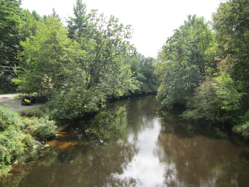 From the Country Road bridge looking downstream on Souhegan River.
The river access is on left of the picture on Sevearns Bridge Road. 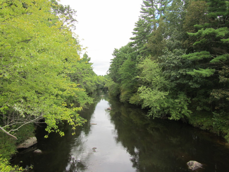 Looking downriver on Souhegan River from the Country Road bridge.
 I scouted the Indian Ledges from the woods at the end of Davidson Avenue in July 2017/
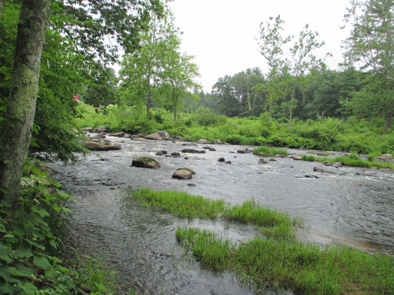
 Rocks at Indian Ledges.
 Rapids at Indian Ledges.
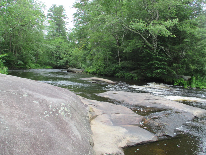
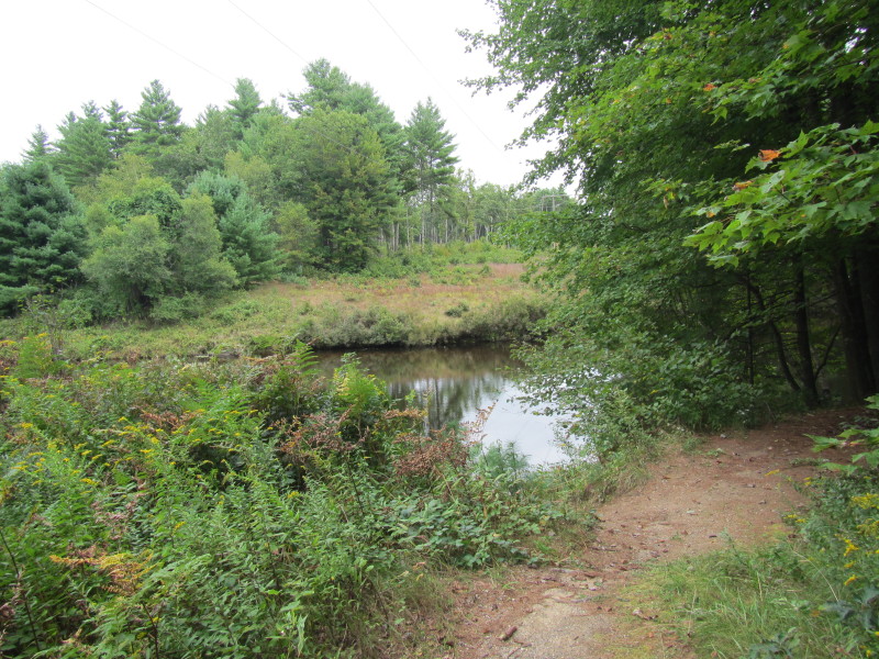
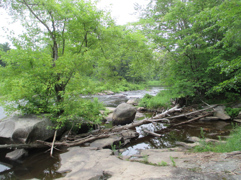 Downstream of the Indian Ledges.
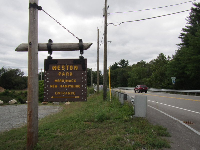 The Weston Park road marker on Turkey Hill Road.
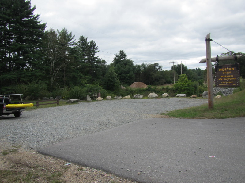 The Weston Park launch area.
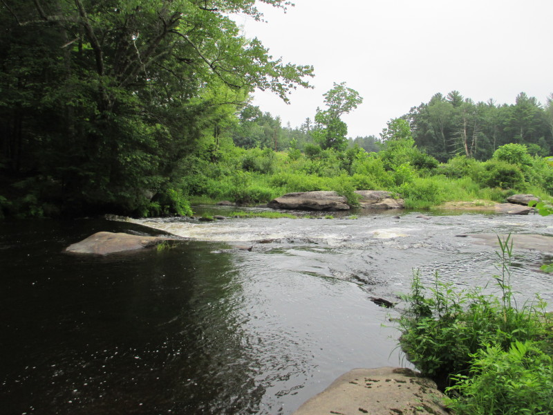
 The Souhegan River viewed from Weston Park.
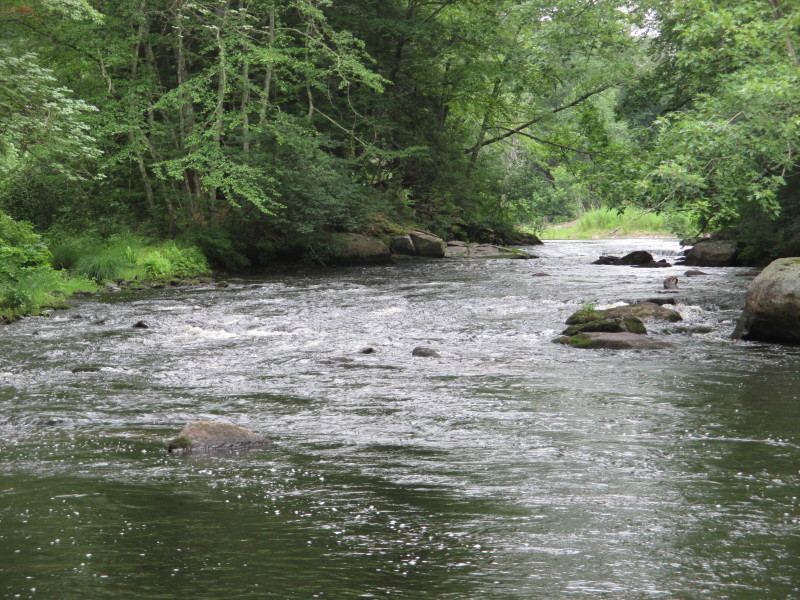
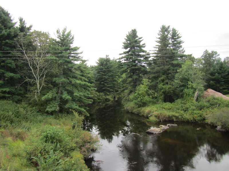
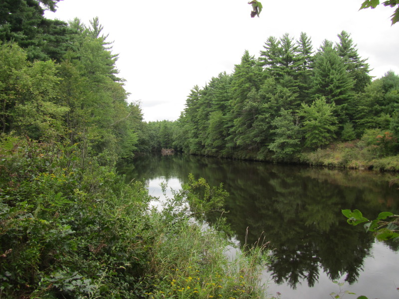
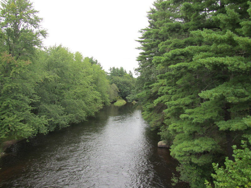 From the Turkey Hill Road bridge, looking downstream on Souhegan River.
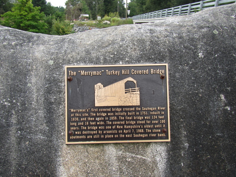
"Merrimac's" first covered bridge crossed the Souhegan River at this site. The bridge was initially built in 1751, rebuilt in 1830, and then again in 1859. The final bridge was 124 feet long and 16 feet wide. The covered bridge stood for over 100 years. The bridge was one of New Hampshire's oldest until it was destroyed by arsonists on April 7, 1968. The stone abutments are still in place on the east Souhegan river bank. 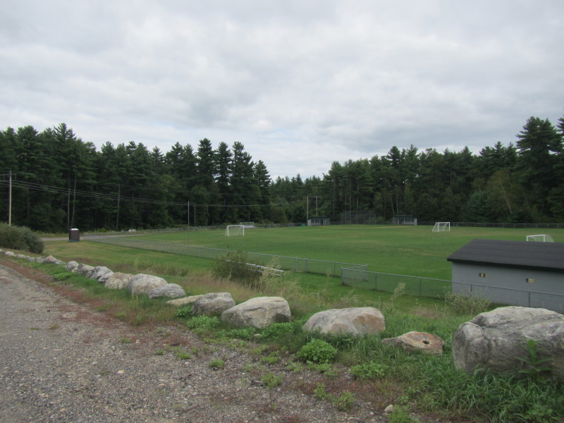 The baseball fields off Atherton Road in Merrimack NH.
Access to the Souhegan River is behind these fields under those power lines. 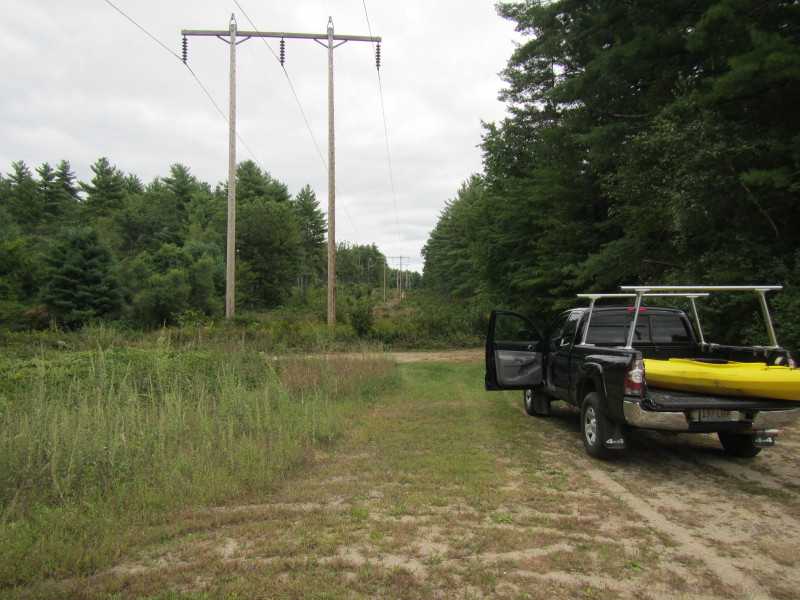 At the access to the Souhegan River at DPW Ball Park.
 Souhegan River looking downstream from the take out at DPW Ball Park.
|