|
Download printer-friendly
PDF version that fits in one page: |
Other resources:
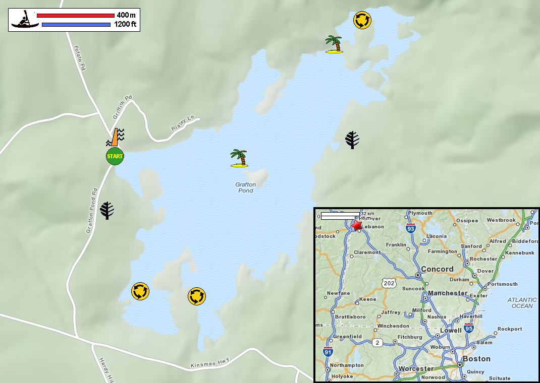
Society for the Protection of New Hampshire Forests: Grafton Pond (with pictures) NH Love It or Leaf It: Grafton Pond is Awesome! Calm Water Paddler: Grafton Pond REI Guidepost: Grafton Pond NH Appalachian Mountain Club: Quiet Water Guide NH Wildlife: Grafton Topographic Map All photos in this website are original and copyrighted. At Grafton Pond on Grafton Pond Road in Grafton NH. Trip date is July 2016. Just next to the launch area is the Grafton Pond Dam. The Boston Kayaker just launched on Grafton Pond in Grafton NH. Just out of the launch cove, veered to my right and will circle Grafton Pond counter-clockwise. The 2 kayakers that launched earlier before me. These islands are all accessible. No "Private Property" signs. On my right is the south western cove (one of two coves) that I will bypass. On the right of this picture is the peninsula creating two coves. Just paddled past the peninsula, going southwards on this southeast cove. Will not pursue the southend tip, veered to my left to go across. Now facing northeast on the eastern side with the coast on my right. One of many pretty micro islands on Grafton Pond. Continuing my northeast direction with the eastern bank on my right. The resident geese on Grafton Pond. It was about 9am and the sun is still low on the east side casting shadows. Approaching the north end of Grafton Pond. I like this rock island. Setting up my tripod for a selfie on my island. The Boston Kayaker on Grafton Pond. Back to the water, will paddle straight ahead to get to the north western shore. Now paddling south westerly direction. Keeping the western shore on my right. Now I can see the launch area. Top of the Grafton Pond. Landed. |