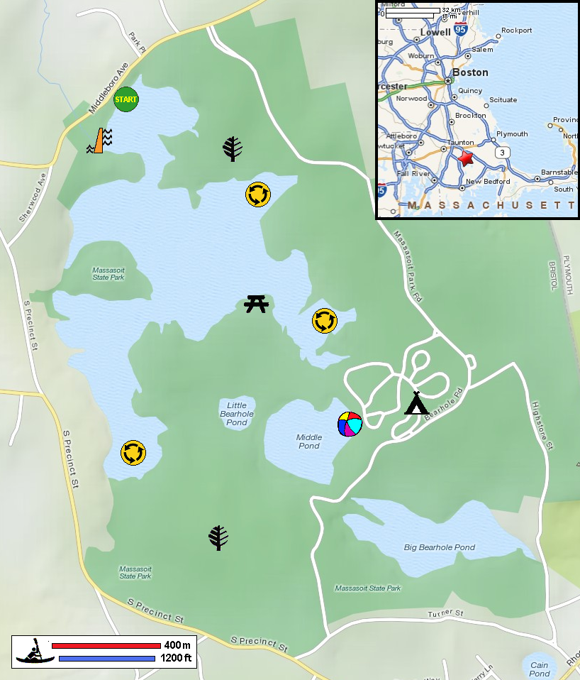
|
Download printer-friendly
PDF version that fits in one page: |
Other resources:
Paddling.net: Lake Rico Kayak Trip Report REI Guidepost: Lake Rico and Big Bearhole Pond Mass. Dept of Conservation: Massasoit State Park Mass. Dept of Conservation: Massasoit State Park Trail Map Mass. Dept of Conservation: Massasoit State Park Trail Map (cached copy) All photos in this website are original and copyrighted. At Lake Rico in Taunton MA. Trip date is June 2012. Lake Rico from the put in. Fishermen. That's the channel to the rest of the arms of the lake. IMG_0750.JPG IMG_0751.JPG IMG_0752.JPG IMG_0753.JPG IMG_0754.JPG IMG_0760.JPG IMG_0763.JPG IMG_0766.JPG IMG_0767.JPG IMG_0768.JPG IMG_0769.JPG IMG_0772.JPG IMG_0775.JPG IMG_0776.JPG IMG_0777.JPG IMG_0778.JPG IMG_0779.JPG IMG_0780.JPG IMG_0781.JPG IMG_0782.JPG IMG_0783.JPG Chopper flying over Lake Rico. Picnic area as shown in the Boston Kayaker's map above. IMG_0790.JPG IMG_0791.JPG IMG_0794.JPG IMG_0795.JPG IMG_0796.JPG IMG_0799.JPG IMG_0800.JPG IMG_0801.JPG IMG_0802.JPG IMG_0803.JPG IMG_0804.JPG IMG_0805.JPG That's Lake Rico dam. Lake Rico dam. Lake Rico on Middleboro Avenue. |